Maps of Athens, Georgia and Vicinity
The Classic City
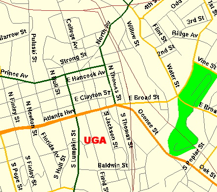
This map illustrates the downtown area, with the main avenue, "Broad Street" (also known as Atlanta Highway) running through it East and West. The University of Georgia occupies a large area south of Broad and East of Lumpkin.
|
 |
|
|
| |
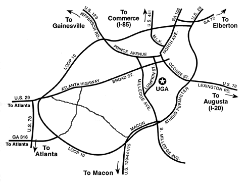
The Athens area is surrounded by a 4 lane divided highway known as the "perimeter" or the "bypass", shown on maps as "Loop 10".
The main East to West artery through town is Atlanta Highway, also known as "Broad Street" in the downtown (business) area. The University, a large sprawling campus, abuts the downtown where Lumpkin crosses Broad Street. |
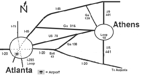
Atlanta also has a loop, I-285. The best route to Athens from Atlanta (and West) is usually I-85 to Rt 316. Best route from North is usually I-85, exit onto Rt 129 south. |
|
|
The locals prefer this route from the airport: Within the airport roads, follow the brown signs which say "Riverdale Road" and when you come to the light as you exit the airport roads, turn left onto Riverdale Road. Go about half a mile (the road will widen) and follow the left lane at the light to get on I-285 (heading North and East), exiting off I-285 onto I-20 west (toward Augusta), then exit 43 onto State Highway 138 north, which then runs into 78, and follow signs to Athens.
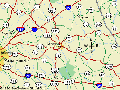
Some other highways surrounding Athens are illustrated in this approach map.
|
|
|
 |